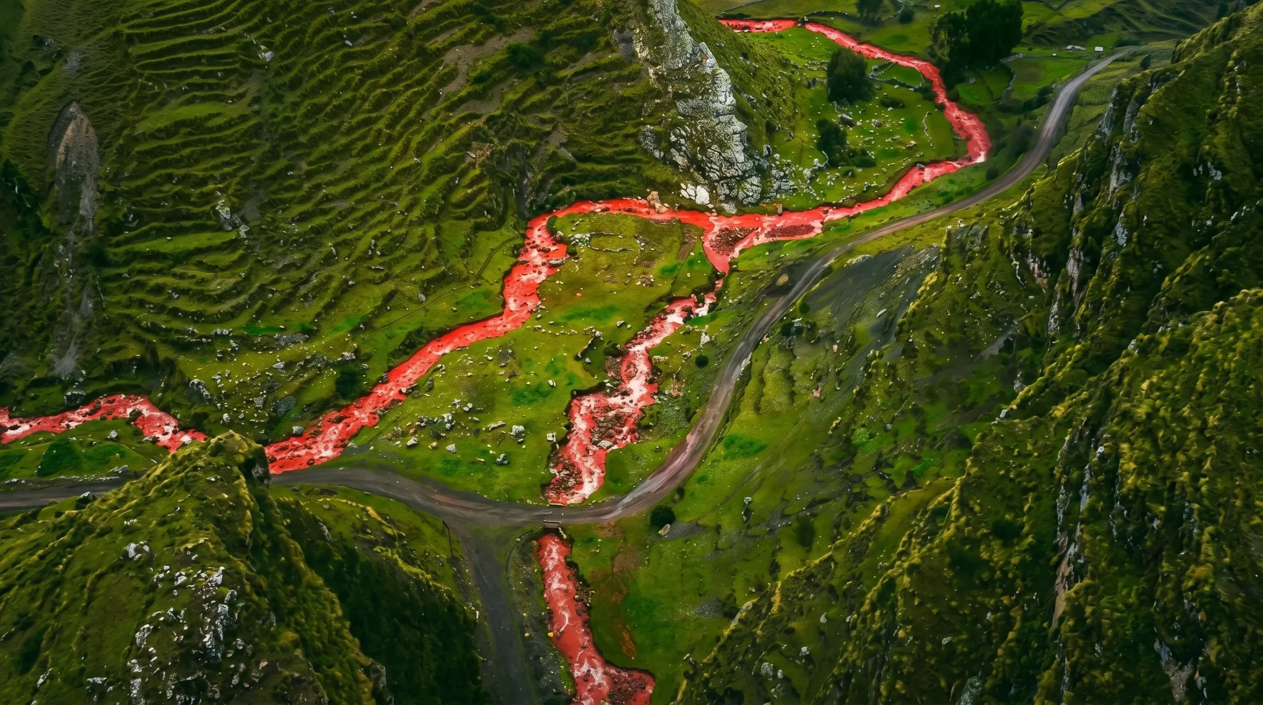
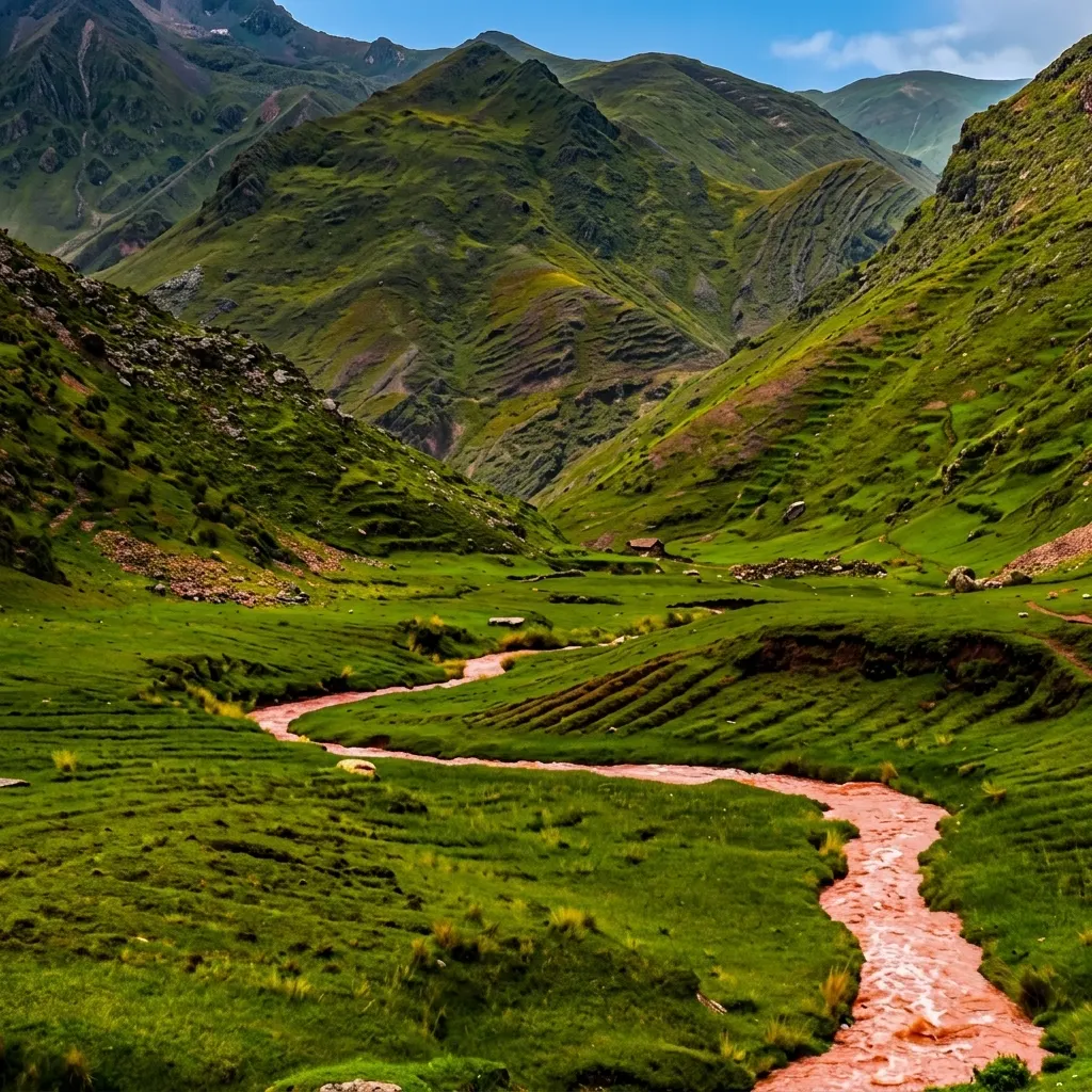
Yes, the Red River in Peru is real. It turns a deep rust red every rainy season in the high Andes above Cusco because iron rich clay washes off the mountains into the stream. It is not in Lima, it is not pollution, and you can only see the color between November and March.
Most travelers find it by accident on the way to Rainbow Mountain. The local Quechua name is Yawar Mayu, which means blood river. On maps you will also see Pukamayu or Palquella Pucamayu. It sits at about 4,710 meters above sea level in Canchis province, roughly 102 kilometers southeast of Cusco city. That altitude means thin air, strong sun and water that is near freezing even when it looks warm in photos.
Why Does the Peru River Turn Red?
The Peru river turns red because seasonal rain erodes layers of hematite and red argillite in the Vilcanota range and keeps that fine sediment suspended in the fast moving water. No chemicals are added. The color is purely mineral.
People often search peru river turns red and river in peru turns red expecting a mystery. The mystery is actually very simple geology. The mountains around Ausangate are striped red, pink and mustard for the same reason. When the slopes get soaked, the mountain literally bleeds into the valley.
Iron Oxide and Red Clay in the Vilcanota Range
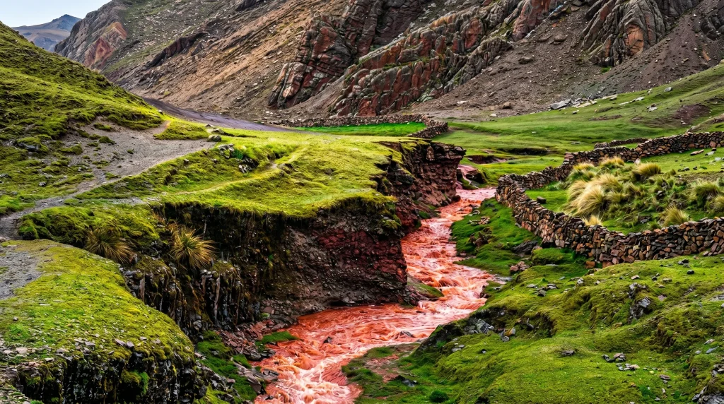
The red color comes from rocks that are 65 million to 2 million years old. The valley walls are made of red sandstone and claystone loaded with iron oxide, the same mineral that makes rust. When dry these rocks are dusty pink. When wet they break down into particles smaller than sand.
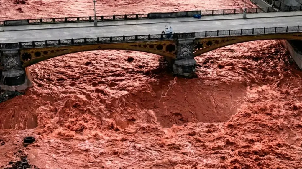
At the Pitumarca viewpoint the river drops about 80 meters over two kilometers. That steep gradient keeps the clay swirling instead of settling. The water can carry up to 15 grams of sediment per liter in January, which is why it looks opaque. Downstream where the slope flattens near Chillcamayu the particles sink and the river turns back to a normal grey green within three kilometers.
You are looking at the same geology that paints Vinicunca Rainbow Mountain at 5,036 meters and the Red Valley next to it. Ausangate, the sacred peak at 6,384 meters, feeds the glaciers that supply the water. Everything in this landscape is connected by iron.
Rainy Season: When the Color Appears (November to March)
The color appears only during the Andean rainy season, from the second week of November to the last week of March. The peak is January and February.
Here is what the weather actually feels like at 4,710 meters, based on SENAMHI station data for Pitumarca:
- November daytime 14 to 17°C, night 1 to 3°C, rain about 70 mm for the month
- December daytime 13 to 16°C, night 0 to 2°C, rain about 120 mm
- January daytime 11 to 14°C, night minus 1 to 2°C, rain about 160 mm
- February daytime 11 to 14°C, night minus 2 to 1°C, rain about 150 mm
- March daytime 12 to 15°C, night 0 to 3°C, rain about 110 mm
If you come in April the river is already clear. The clay hardens and the water runs transparent until the next November. The best photos happen after two or three days of steady rain, not during a storm, because the light is softer and the color is fully saturated.
Where Is the Red River in Cusco, Peru?
The Red River in Cusco is in the Canchis province, in two separate high valleys of the Vilcanota range. Both are about a two hour drive from Cusco plus a short hike. The coordinates most photographers use are 13.979° S, 71.245° W for the Pitumarca side.
It is not a single tourist park. There are no entrance gates. You walk through community land where alpacas graze above 4,500 meters.
Pitumarca and the Route to Vinicunca Rainbow Mountain
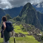
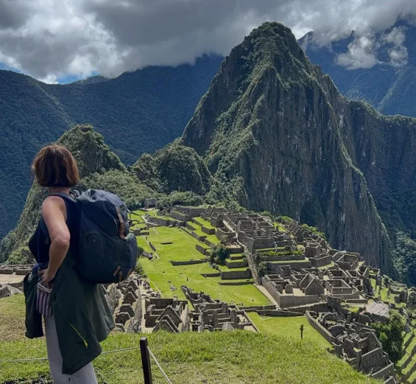
The Pitumarca red river is the classic one and the one that matches the search red river of the rainbow mountains peru. You start in Pitumarca town at 3,570 meters. From the main square a dirt road climbs 22 kilometers to the community of Japura at 4,400 meters. From Japura it is a 2.5 hour walk uphill to the bridge where the water is deepest red.
On this walk you pass the Red Valley, which stays red all year because it is dry rock, not water. You will also see small glacial lakes like Singrenacocha at 4,650 meters and herds of vicuña. The viewpoint for the river is at 4,710 meters, about 40 minutes before you reach the Vinicunca summit.
This is the route to choose if you want the most intense color. The water here runs through a narrow canyon so the sediment stays concentrated.
Palcoyo Red River and the Combapata Access
The Palcoyo red river is easier on the lungs and matches searches for palcoyo red river in cusco peru and palccoyo peru red river. You drive from Cusco to Combapata at 3,466 meters, about 95 kilometers on paved highway. From Combapata you climb 35 kilometers on a gravel road to Palcoyo at 4,650 meters.
The river here spreads into three shallow braids across a wide plain. The color is a lighter terracotta because the source rock has more yellow sandstone mixed in. The walk from the parking area is only 15 minutes on flat ground. The altitude gain is less than 200 meters, which makes it a better choice if you arrived in Cusco the day before.
Both rivers are locally called Pukamayu. Asking for that name will get you better directions than saying red river.
Is the Lima Peru River the Same? Red Water vs Pollution
No, the Lima Peru river is not the same. The red water events in Lima are urban pollution, not a natural mineral river like in Cusco. This is the key difference Google is trying to understand when people search lima peru river turns red.
In 2023 and early 2024 the Rimac River in downtown Lima turned bright red for several hours. The National Water Authority confirmed it was textile dye illegally dumped upstream, mixed with construction runoff high in iron. Fish died, the water smelled chemical, and the color disappeared the same day after authorities closed the discharge.
The Cusco river has run red every rainy season for centuries and is documented in Quechua oral history. There is no industry above 4,000 meters in that valley.
Natural Mineral Rivers vs Urban Contamination in Lima
You can separate the two stories in seconds:
- Altitude and setting. Cusco is at 4,710 meters in a protected pastoral valley with no factories. Lima is at sea level in a city of 10 million people.
- Timing. Cusco is predictable November to March. Lima events are random and last hours.
- Water chemistry. Cusco water is cold, odorless and supports Andean geese and trout. Lima red events tested high for synthetic dyes and heavy metals.
- Community use. Families in Pitumarca let alpacas drink from the red river. No one in Lima would use the Rimac for drinking during a color event.
If your search intent is travel and photography, focus on Canchis, Cusco. If your intent is environmental news, focus on Rimac, Lima.
Best Time to Visit and How to Get There
The best time to visit is between mid December and early March, with January offering the strongest color and February offering slightly more stable weather. Go in the morning between 8 and 11 am for the best light and fewer clouds.
You need a full day from Cusco. Bring layers, because you will start at 3,399 meters in Cusco and end at 4,710 meters at the river. The temperature swing is often 18 degrees in one day.
Can You Visit on Your Own From Cusco?
Yes, you can visit on your own from Cusco and it costs less than 30 dollars if you use public transport. Most people do it without a tour.
For Pitumarca:
- Take a Cusco Sicuani bus from Avenida Huayruropata before 6:30 am. Fare is 12 to 15 soles. Get off in Checacupe after about 2 hours.
- Take a colectivo to Pitumarca, 10 minutes, 3 soles.
- In Pitumarca hire a local driver to Japura. Negotiate 80 to 100 soles round trip and ask him to wait four hours.
- Walk 2.5 hours up the marked trail to the red river bridge. The path follows a blue water pipe, you cannot get lost.
For Palcoyo:
- Take the same bus but stay on until Combapata, about 2 hours 30 minutes.
- Hire a taxi in Combapata main square to Palcoyo community, 70 to 90 soles round trip.
- Walk 15 minutes to the river braids.
Independent travel gives you time for photos. Tours rush you because they combine the river with Rainbow Mountain. If you go alone, spend at least one night in Cusco first to acclimatize, carry two liters of water, and do not rely on phone signal above 4,500 meters.
The Red River in Peru is not a year round attraction. It is a seasonal signal that the mountains are alive and moving. Arrive in the rainy season, go to the right valley in Canchis, and you will understand why locals still call it Yawar Mayu.
Frequently Asked Questions About the Red River Peru
No. The water stays between 3°C and 6°C even in summer, the current is strong after rain, and local communities consider Yawar Mayu a spiritual water source
There is no national park fee. The Quechua communities of Japura and Palcoyo collect a voluntary maintenance contribution of 5 to 10 soles at the trailhead
You will most likely see Andean geese, vizcachas among the rocks, and herds of alpaca. Condors fly over Ausangate but are rare below 5,000 meters
Yes. The color is natural iron clay, not chemicals. Alpacas and sheep drink downstream daily during the rainy season without issues
Doctors in Cusco recommend at least 48 hours above 3,300 meters, light meals, no alcohol, and sleeping two nights in Cusco before attempting the river
In Quechua Yawar Mayu translates as blood river. Elders in Pitumarca say the color appears when the Pachamama awakens with the first rains